The Mediterranean and the Near East today
Every mint in the collection on one modern map, from Britain to Iran. The number beside each ring is how many of my coins were struck there. Tap a ring for that mint; pinch or zoom to look closer.
44 places, 116 coins, on today's map
The maps on each coin’s page show the ancient world as the coin knew it, with the ancient names: Lydia, Ionia, Magna Graecia, Seleucis and Pieria. Good maps, but they do not tell a reader who knows only today’s geography where on earth the place is. This page does that. Every mint in my collection is a red ring on a modern map, with the number of my coins struck there, and under each regional map is a line for each mint saying what the place is called now and how to find it from a city you know. Below those are the Ancient World Mapping Center’s classroom maps, which carry the ancient names the coin pages use and so are the step between this page and a coin’s own map.
Jump to: the overview · West · Italy · Greece · Asia Minor · East · the ancient maps · by ancient region
Every mint in the collection on one modern map, from Britain to Iran. The number beside each ring is how many of my coins were struck there. Tap a ring for that mint; pinch or zoom to look closer.
Londinium is London; Lugdunum is Lyon; Arelate is Arles; Carthage is a suburb of Tunis.
The modern Lyon, in east-central France where the Rhône meets the Saône, about 390 km southeast of Paris.
4 types, 5 coins
On the Gulf of Tunis on the north coast of Tunisia, about 15 km northeast of central Tunis.
3 types, 3 coins
The modern Arles on the Rhône in southern France, about 75 km northwest of Marseille.
1 type, 1 coin
Beneath the City of London, on the north bank of the Thames in southeast England.
1 type, 1 coin
The ancient maps for this area: The Western Mediterranean in the third century BC · Rome's northern provinces around AD 100 · Europe, North Africa and West Asia: the ancient regions · The Roman Empire in AD 69 · The Roman Empire of Diocletian and Constantine.
Rome is Rome. The Greek cities of the south and of Sicily — Syracuse, Akragas, Kaulonia — are on the coasts an Italian holiday brochure would show.
The modern city of Rome, in central Italy about 25 km inland from the Tyrrhenian coast.
29 types, 29 coins
The modern Siracusa on the east coast of Sicily, about 50 km south of Catania.
4 types, 13 coins
The modern Agrigento on the south coast of Sicily, about 95 km south of Palermo.
1 type, 1 coin
On the Ionian coast of Calabria at the toe of Italy, by Monasterace Marina, about 50 km south of Catanzaro. (Not the modern town named Caulonia, which is 12 km to the southwest.)
1 type, 1 coin
The ancient maps for this area: Italy and Sicily · Southern Italy and Sicily · The Western Mediterranean in the third century BC · Europe, North Africa and West Asia: the ancient regions · The Roman Empire in AD 69 · The Roman Empire of Diocletian and Constantine.
Southern Greece and the Aegean islands; Macedonia and Thrace to the north; the Roman mints on the Danube (Sirmium, Serdica) in today's Serbia and Bulgaria.
The modern Greek capital, about 8 km inland from the Saronic Gulf.
4 types, 4 coins
In northern Greece, about 40 km west of Thessaloniki, beside the modern village of the same name.
2 types, 4 coins
In northern Greece, about 80 km east of Thessaloniki and 5 km inland from the north Aegean coast.
2 types, 2 coins
At the village of Ancient Corinth on the isthmus joining the Peloponnese to mainland Greece, about 75 km west of Athens.
2 types, 2 coins
On the slopes of Mount Parnassus in central Greece, about 120 km northwest of Athens and 10 km from the Gulf of Corinth.
1 type, 2 coins
The modern Larissa in the plain of central Greece, about 55 km northwest of Volos and 120 km southwest of Thessaloniki.
2 types, 2 coins
The modern Patras, on the Gulf of Patras at the northwest corner of the Peloponnese in western Greece, about 175 km west of Athens.
2 types, 2 coins
On the eastern shore of the Ambracian Gulf in western Greece, about 8 km north of the town of Amfilochia and 90 km northwest of Patras. (Pleiades marks the location as rough (a representative point near Loutro-Krikellos); the English Wikipedia coordinate differs by about 15 km and is less consistent with the published identification.)
1 type, 1 coin
In the plain of central Greece, about 18 km southwest of Larissa, near the village of Krannonas.
1 type, 1 coin
On the neck of the Gallipoli peninsula in northwestern Turkey, near the village of Bolayır, about 195 km west of Istanbul. (Thrace; Pleiades lists the site as Kardia/Lysimacheia (501458).)
1 type, 1 coin
The modern Farsala in central Greece, about 40 km south of Larissa.
1 type, 1 coin
The town of Rhodes at the northern tip of the island of Rhodes in the southeastern Aegean, about 30 km off the Turkish coast. (The city (Pleiades 590030), not the island (590031).)
1 type, 1 coin
The modern Sofia, capital of Bulgaria, in the west of the country about 235 km north of Thessaloniki.
1 type, 1 coin
Beneath the modern Sremska Mitrovica on the Sava river in northern Serbia, about 70 km west of Belgrade. (Pannonia, outside all five groups; put with the Balkans under Greece.)
1 type, 1 coin
The modern Thiva in central Greece, about 50 km northwest of Athens.
1 type, 1 coin
The modern Thessaloniki, Greece's second city, at the head of the Thermaic Gulf in northern Greece.
1 type, 1 coin
The ancient maps for this area: The Aegean Sea and Greece · Rome's northern provinces around AD 100 · Europe, North Africa and West Asia: the ancient regions · The Roman Empire in AD 69 · The Roman Empire of Diocletian and Constantine.
Asia Minor is the Asian part of Turkey. The Ionian mints (Miletos, Teos, Kolophon) and Sardes are inland from Izmir; Kyzikos and Byzantion are on the Sea of Marmara; Amisos is Samsun on the Black Sea coast; Panticapaeum is Kerch in Crimea.
In western Turkey, about 80 km east of Izmir, beside the village of Sart.
5 types, 5 coins
On the south shore of the Sea of Marmara in northwestern Turkey, near Erdek, about 115 km southwest of Istanbul.
4 types, 4 coins
The modern Samsun on the Black Sea coast of northern Turkey, about 330 km northeast of Ankara.
1 type, 2 coins
In southern Turkey, about 40 km east of Antalya and 15 km inland from the Mediterranean, by the village of Belkıs.
2 types, 2 coins
The old city of Istanbul, on the European side of the Bosporus where it opens into the Sea of Marmara. (Thrace; Pleiades 520985 is Byzantium proper, distinct from its Constantinopolis record.)
1 type, 1 coin
In western Turkey, about 35 km south of Izmir and a few km inland from the Aegean, by the village of Değirmendere.
1 type, 1 coin
In southwestern Turkey near the village of Balat, about 100 km south of Izmir; once a port, now 8 km inland behind the silted delta of the Büyük Menderes river.
1 type, 1 coin
The modern Kerch, on the strait between the Black Sea and the Sea of Azov at the eastern tip of the Crimean peninsula.
1 type, 1 coin
The harbour quarter of modern Paphos on the southwest coast of Cyprus, about 60 km west of Limassol. (Nea Paphos (Pleiades 707586), the Hellenistic and Roman mint; the old town of Palaipaphos lies 16 km southeast at Kouklia.)
1 type, 1 coin
The modern Tarsus in southern Turkey, about 40 km west of Adana and 20 km inland from the Mediterranean.
1 type, 1 coin
On the Aegean coast of western Turkey, about 40 km southwest of Izmir, beside the harbour village of Sığacık.
1 type, 1 coin
The ancient maps for this area: The Aegean Sea and Greece · The eastern empire in the early second century AD · Europe, North Africa and West Asia: the ancient regions · The Roman Empire in AD 69 · The Roman Empire of Diocletian and Constantine.
Antioch is Antakya in southern Turkey; Carrhae is Harran; Susa and Ekbatana are in western Iran; Alexandria and Memphis are in Egypt; Jerusalem and Caesarea are in Israel.
The modern Antakya in the southernmost corner of Turkey, about 25 km inland from the Mediterranean and 90 km west of Aleppo in Syria.
4 types, 4 coins
The modern Hamadan in western Iran, about 280 km southwest of Tehran.
3 types, 3 coins
The modern city of Jerusalem, in the hills about 55 km east of Tel Aviv.
2 types, 2 coins
The modern Alexandria on Egypt's Mediterranean coast, about 180 km northwest of Cairo.
1 type, 1 coin
On the Mediterranean coast of Israel, about 45 km north of Tel Aviv and 35 km south of Haifa.
1 type, 1 coin
The modern Harran in southeastern Turkey, about 40 km southeast of Şanlıurfa and 18 km from the Syrian border.
1 type, 1 coin
The port of Latakia on Syria's Mediterranean coast, about 145 km southwest of Aleppo.
1 type, 1 coin
At the village of Mit Rahina on the west bank of the Nile, about 20 km south of Cairo.
1 type, 1 coin
Beside the town of Shush in southwestern Iran, about 105 km north of Ahvaz.
1 type, 1 coin
The ancient maps for this area: The eastern empire in the early second century AD · Ptolemaic Egypt, about 270 BC · Roman Egypt · Europe, North Africa and West Asia: the ancient regions · The Roman Empire in AD 69 · The Roman Empire of Diocletian and Constantine.
Classroom maps from the Ancient World Mapping Center at the University of North Carolina, published under CC BY-SA 4.0. These carry the ancient names and the provinces, so a region on a coin page can be found here and then on the modern maps above. Pinch or zoom to read one closely.
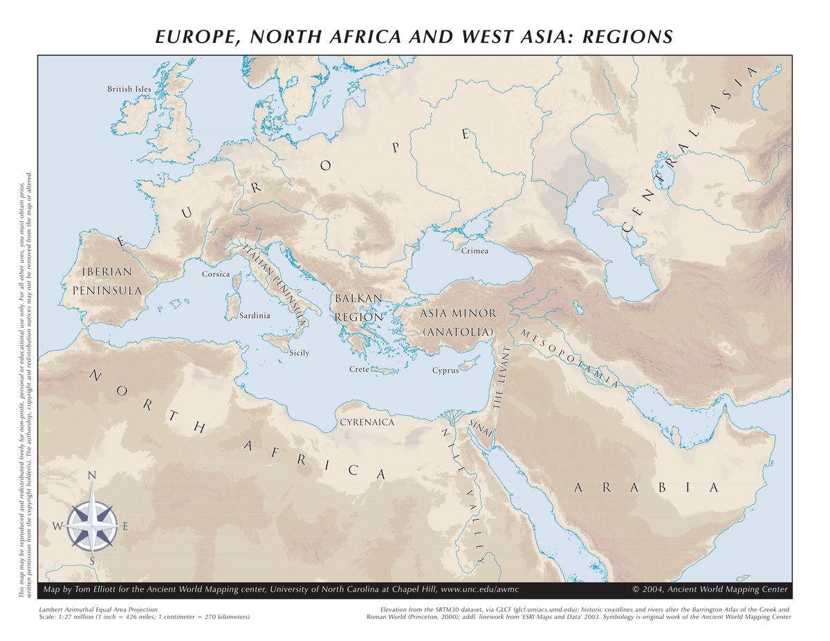
Ancient World Mapping Center, University of North Carolina at Chapel Hill (awmc.unc.edu), Europe, North Africa and West Asia Regions.pdf on Wikimedia Commons, licensed CC BY-SA 4.0. Rendered from the Center's PDF, unchanged.
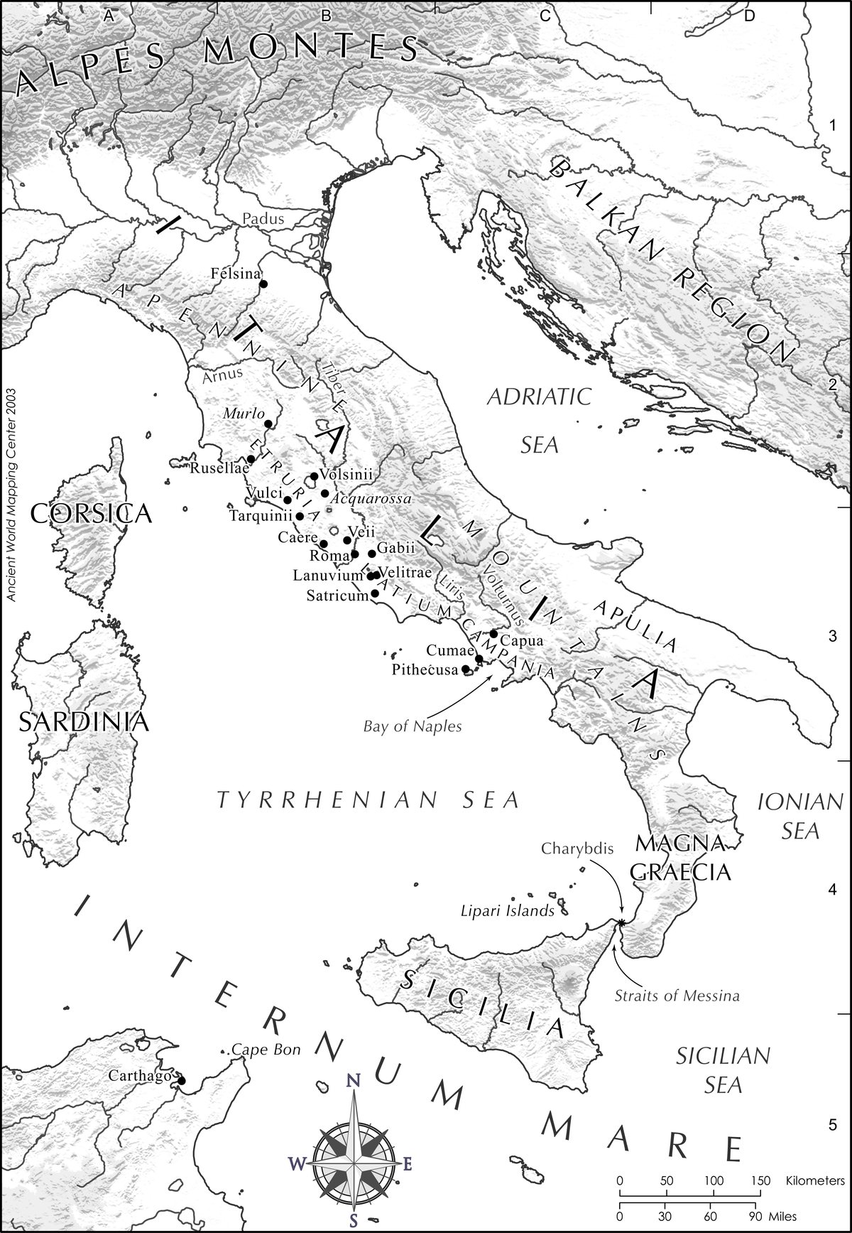
Ancient World Mapping Center, University of North Carolina at Chapel Hill (awmc.unc.edu), Italy and Sicily.pdf on Wikimedia Commons, licensed CC BY-SA 4.0. Rendered from the Center's PDF, unchanged.
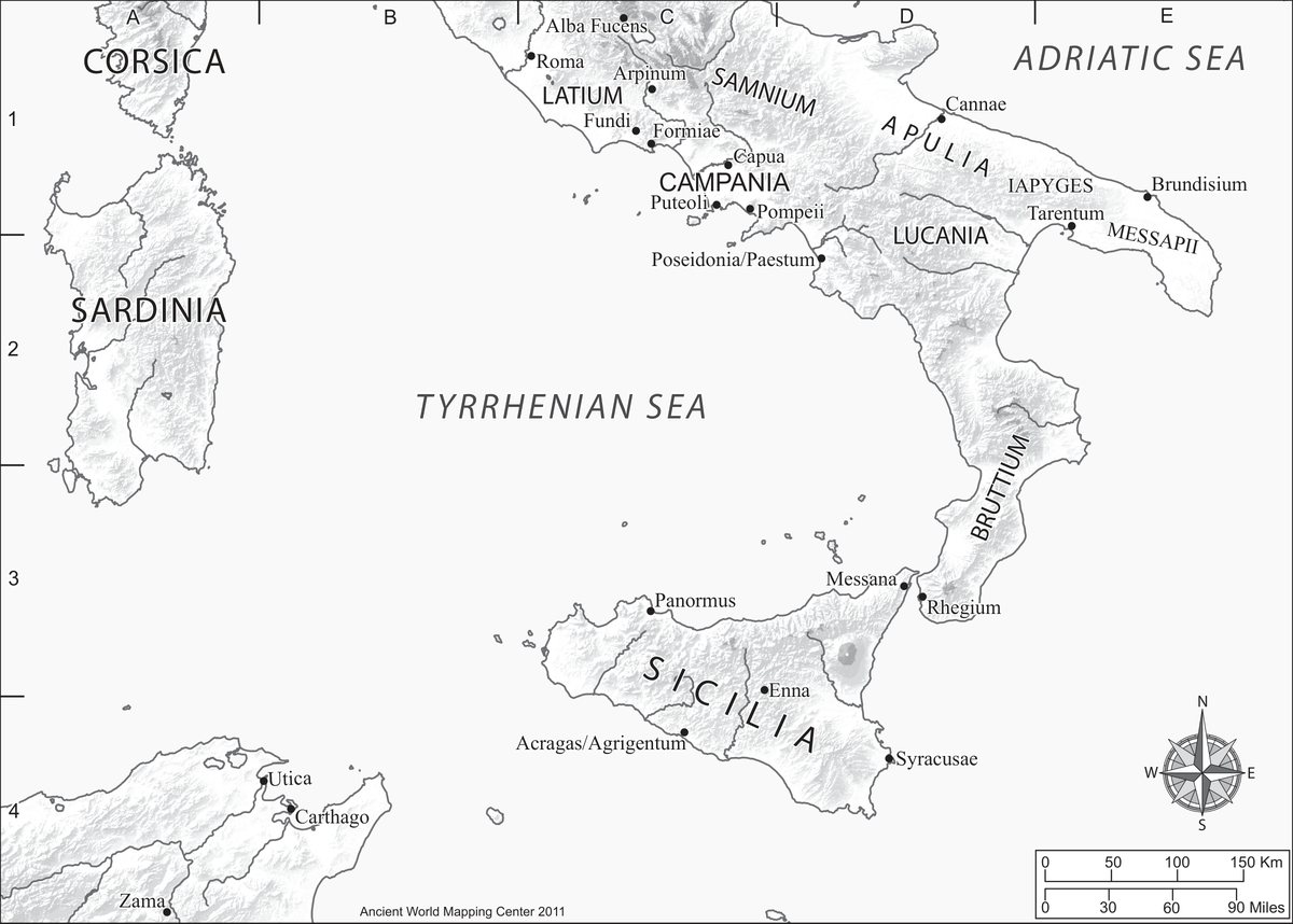
Ancient World Mapping Center, University of North Carolina at Chapel Hill (awmc.unc.edu), Southern Italy and Sicily.pdf on Wikimedia Commons, licensed CC BY-SA 4.0. Rendered from the Center's PDF, unchanged.
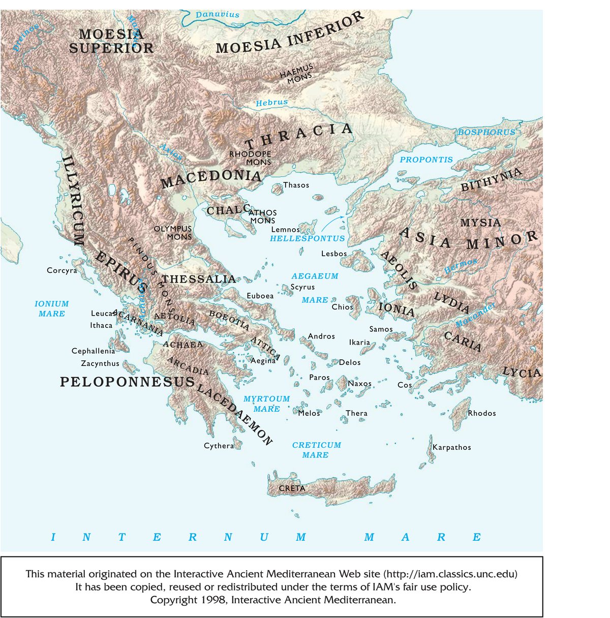
Ancient World Mapping Center, University of North Carolina at Chapel Hill (awmc.unc.edu), The Aegean Sea and Greece.pdf on Wikimedia Commons, licensed CC BY-SA 4.0. Rendered from the Center's PDF, unchanged.
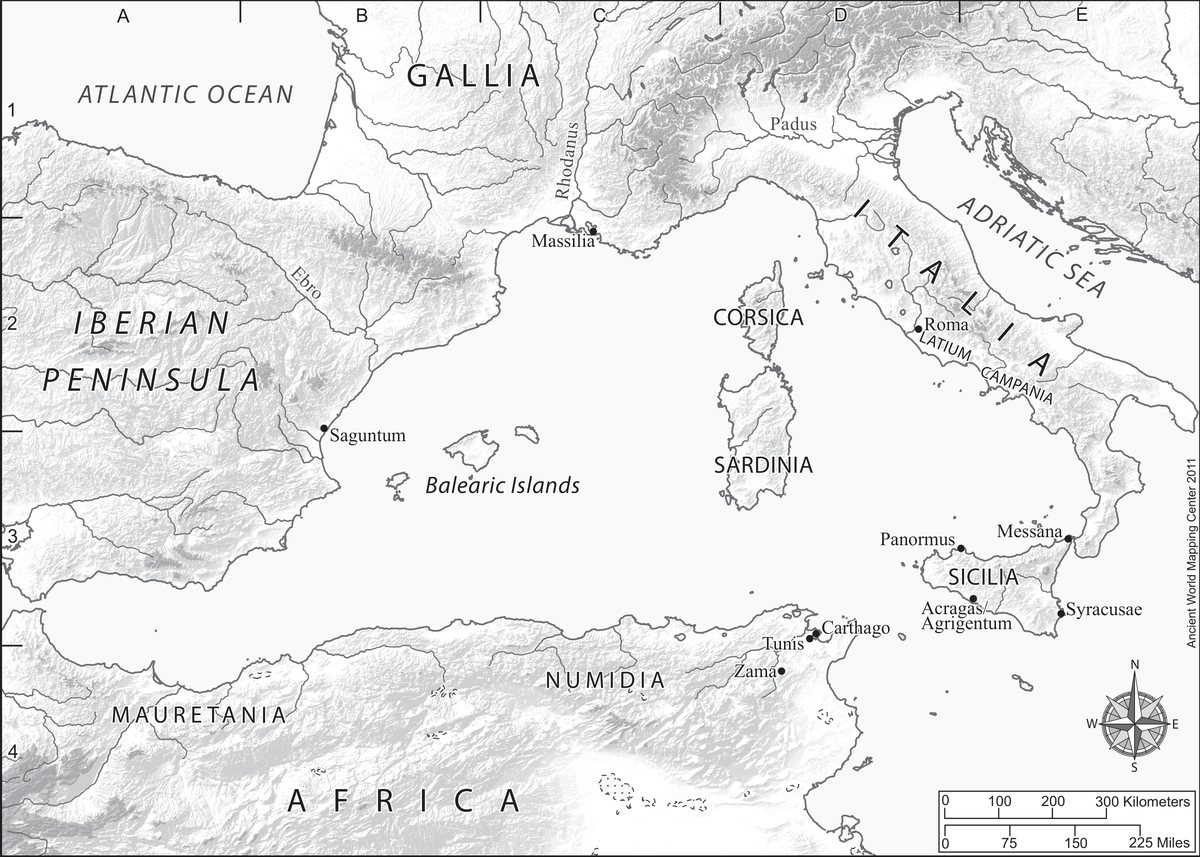
Ancient World Mapping Center, University of North Carolina at Chapel Hill (awmc.unc.edu), Western Mediterranean in the Third Century BCE.pdf on Wikimedia Commons, licensed CC BY-SA 4.0. Rendered from the Center's PDF, unchanged.
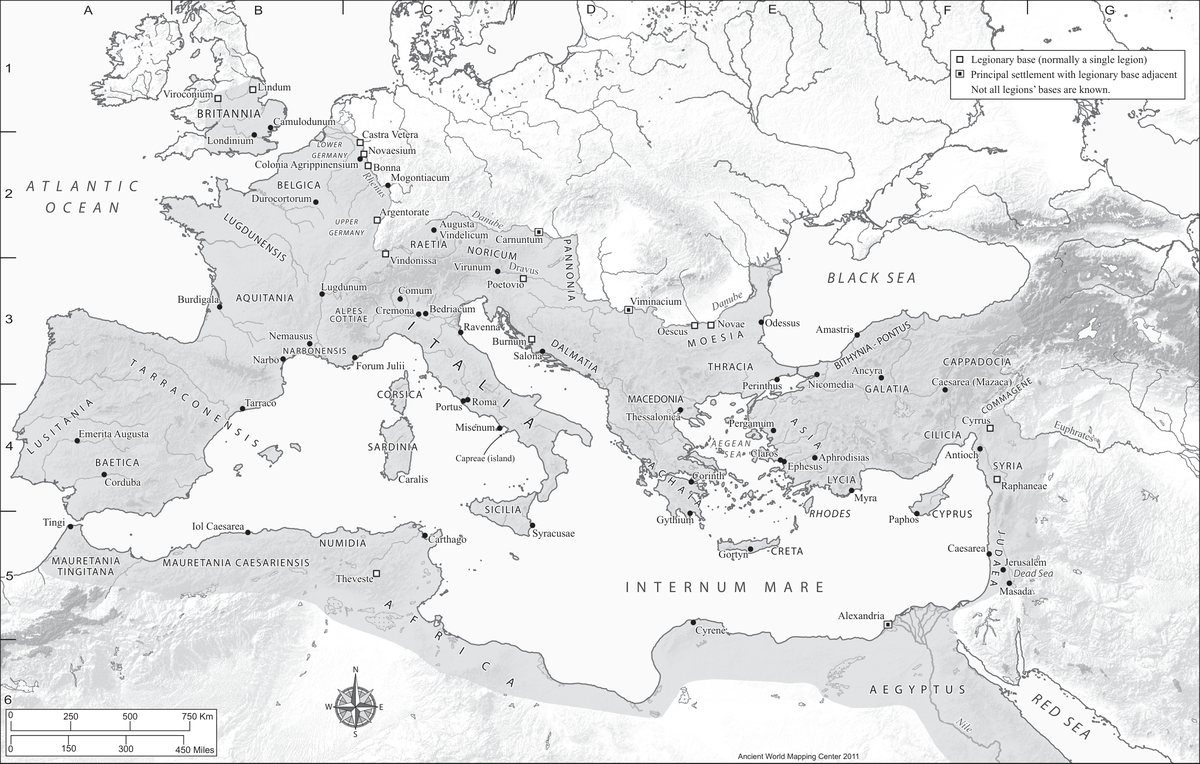
Ancient World Mapping Center, University of North Carolina at Chapel Hill (awmc.unc.edu), Roman Empire in AD 69.pdf on Wikimedia Commons, licensed CC BY-SA 4.0. Rendered from the Center's PDF, unchanged.
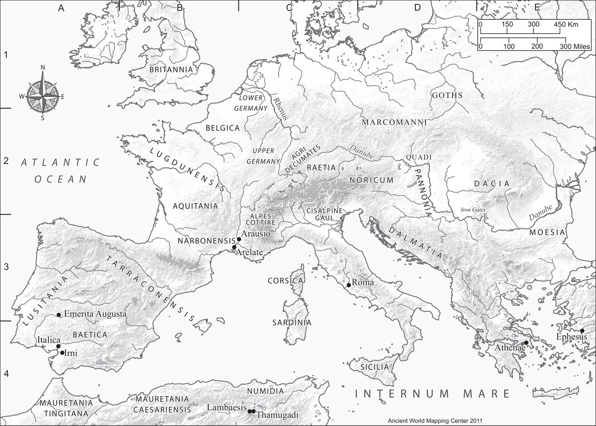
Ancient World Mapping Center, University of North Carolina at Chapel Hill (awmc.unc.edu), Rome's Northern Provinces Around AD 100.pdf on Wikimedia Commons, licensed CC BY-SA 4.0. Rendered from the Center's PDF, unchanged.
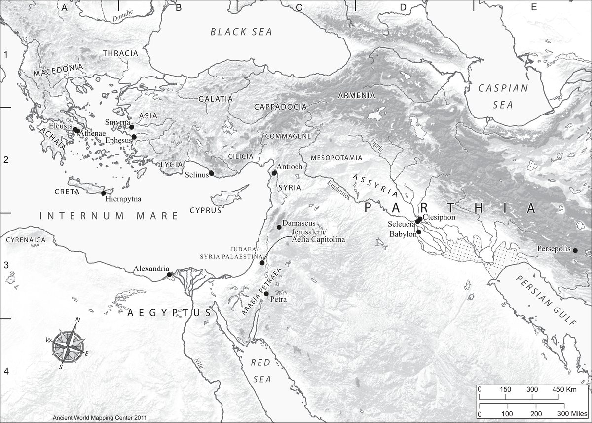
Ancient World Mapping Center, University of North Carolina at Chapel Hill (awmc.unc.edu), Eastern Expansion of the Empire in the Early Second Century.pdf on Wikimedia Commons, licensed CC BY-SA 4.0. Rendered from the Center's PDF, unchanged.
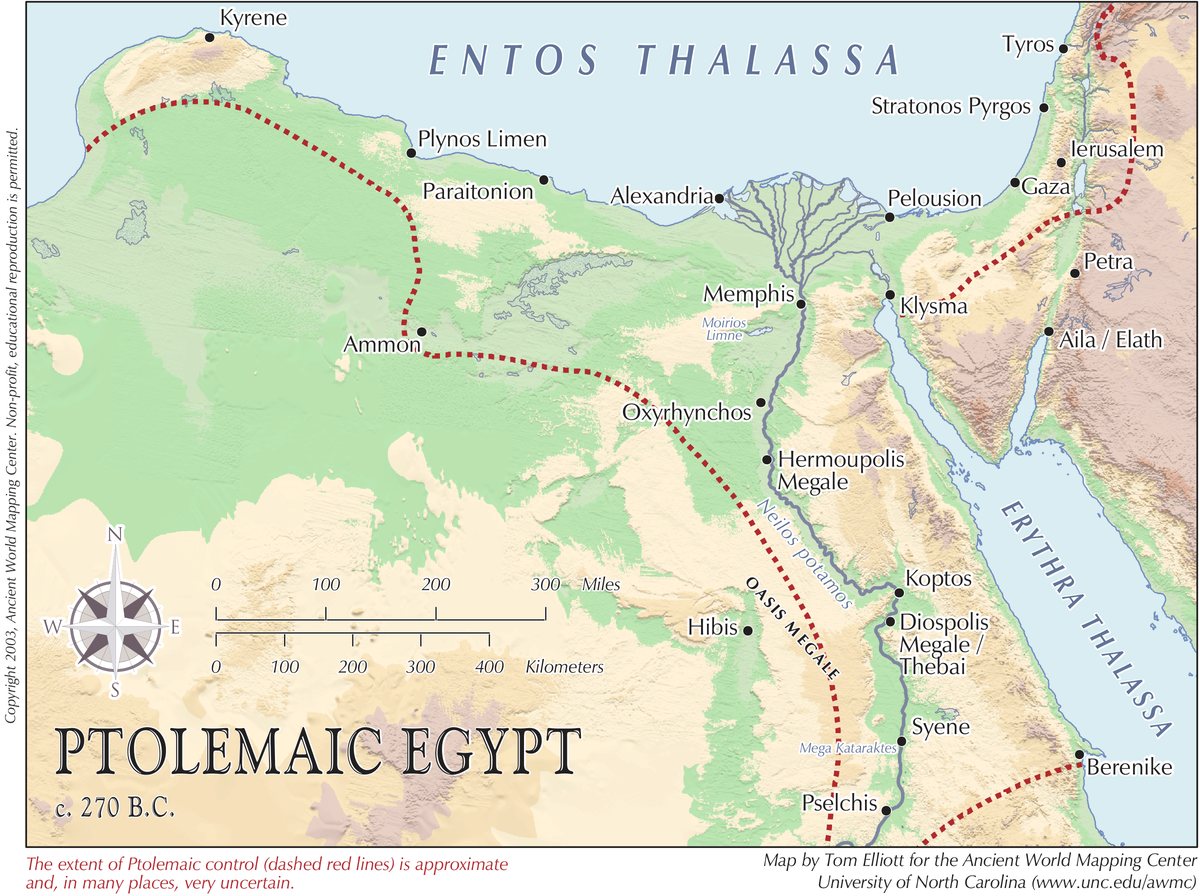
Ancient World Mapping Center, University of North Carolina at Chapel Hill (awmc.unc.edu), Ptolemaic Egypt, circa 270 BCE.pdf on Wikimedia Commons, licensed CC BY-SA 4.0. Rendered from the Center's PDF, unchanged.
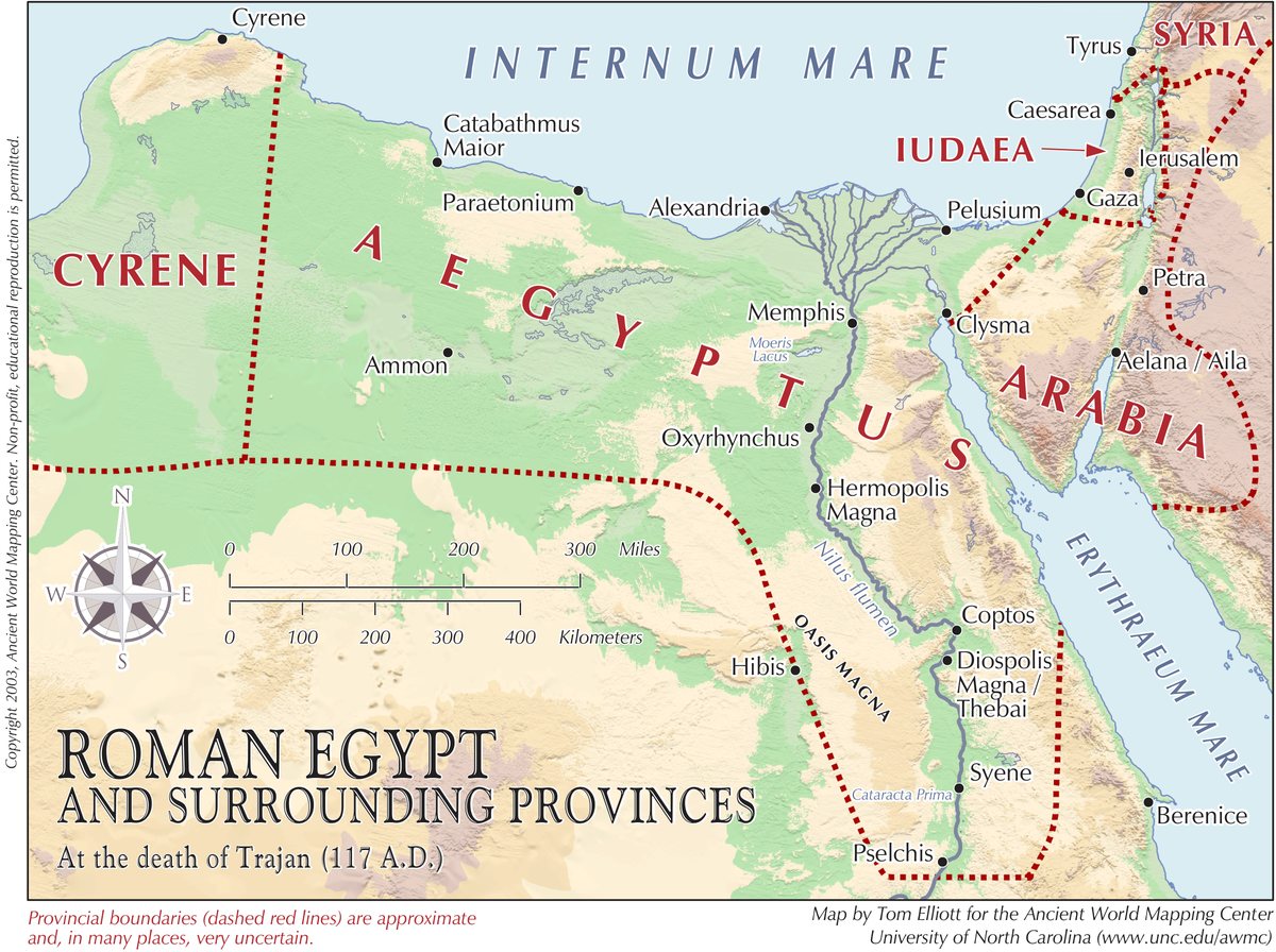
Ancient World Mapping Center, University of North Carolina at Chapel Hill (awmc.unc.edu), Roman Egypt.pdf on Wikimedia Commons, licensed CC BY-SA 4.0. Rendered from the Center's PDF, unchanged.
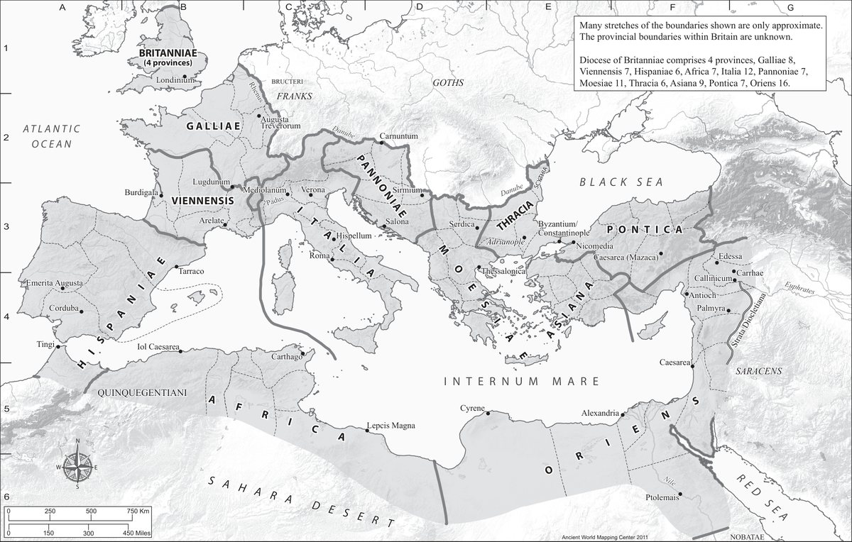
Ancient World Mapping Center, University of North Carolina at Chapel Hill (awmc.unc.edu), Roman Empire of Diocletian and Constantine.pdf on Wikimedia Commons, licensed CC BY-SA 4.0. Rendered from the Center's PDF, unchanged.
Every type, grouped by the region named on its card. A mint's name links to its entry above.
Where the mints are — every mint in the collection on a modern map
Site Credits — photograph, map and graphic attributions


